FORT WAYNE, Ind. (WOWO): The National Weather Service is warning residents across Northeast Indiana to prepare for the potential of significant severe weather Wednesday, including damaging winds, large hail, flooding, and the possibility of strong tornadoes.
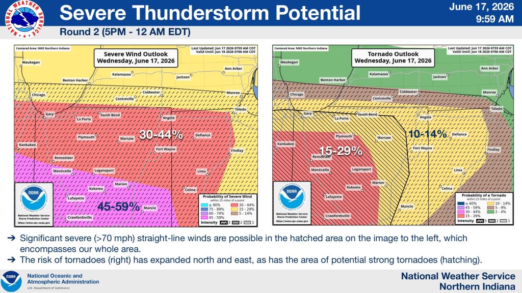 Forecasters continue to place much of northern Indiana under an Enhanced Risk (Level 3 of 5) for severe weather, with portions of northwest Indiana under a Moderate Risk (Level 4 of 5). The National Weather Service says only minor adjustments were made in its latest briefing, but confidence remains high that severe storms will develop later today.
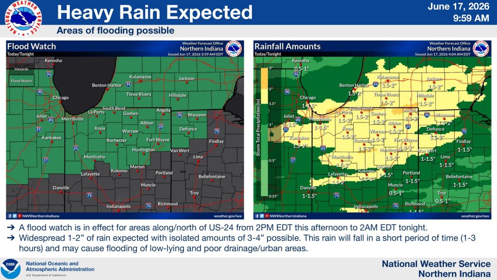
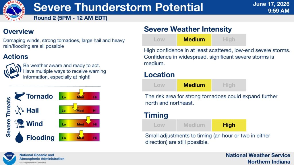 The greatest concern arrives during the second round of storms from 5 p.m. through midnight. The National Weather Service says these storms could generate wind gusts exceeding 70 mph, large hail, flash flooding, and tornadoes, including the potential for strong tornadoes. Forecasters note that the tornado threat area has expanded farther north and east since earlier forecasts.