
STATEWIDE (NETWORK INDIANA) — Hurricane Beryl hit Texas’ Gulf Coast early Monday as a category one storm, packing sustained winds of 80 MPH. Forecasters say Hoosiers might feel its effects with significant rainfall and potential tornadoes.
The National Hurricane Center says Beryl is currently located approximately 20 miles southwest of Houston, with maximum sustained winds of 75 miles per hour.
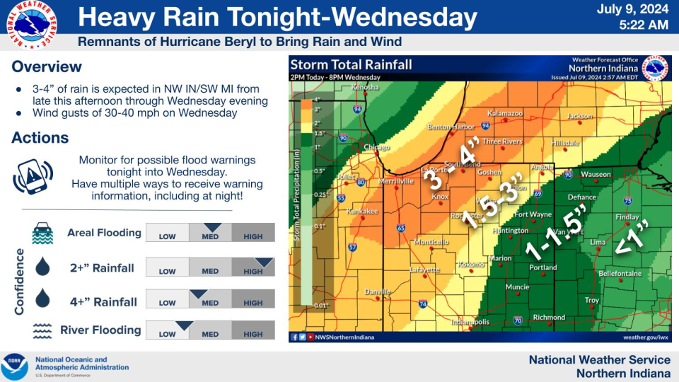
“You’re probably talking about heavy rainfall rates,” says WISH-TV Meteorologist Marcus Bailey. “Half an inch to an inch per hour, maybe a bit more in some spots.”
Some areas of Indiana are experiencing moderate drought conditions. Bailey says it’s beneficial when systems like Beryl pass through as long as they don’t bring excessive flooding.
“Most of the time in the summertime, you’ve got these scattered thunderstorms, so while some areas could get a decent amount of rain when you do have storms chances, some areas may not see a drop,” Bailey added.
Bailey says it’s been over two years since Indiana last received a good rain from a tropical system. He adds the best chance for significant rainfall this week will be on Tuesday into Wednesday.