
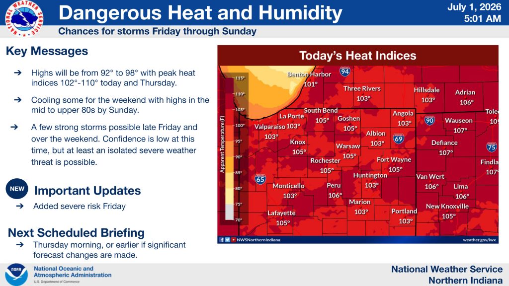
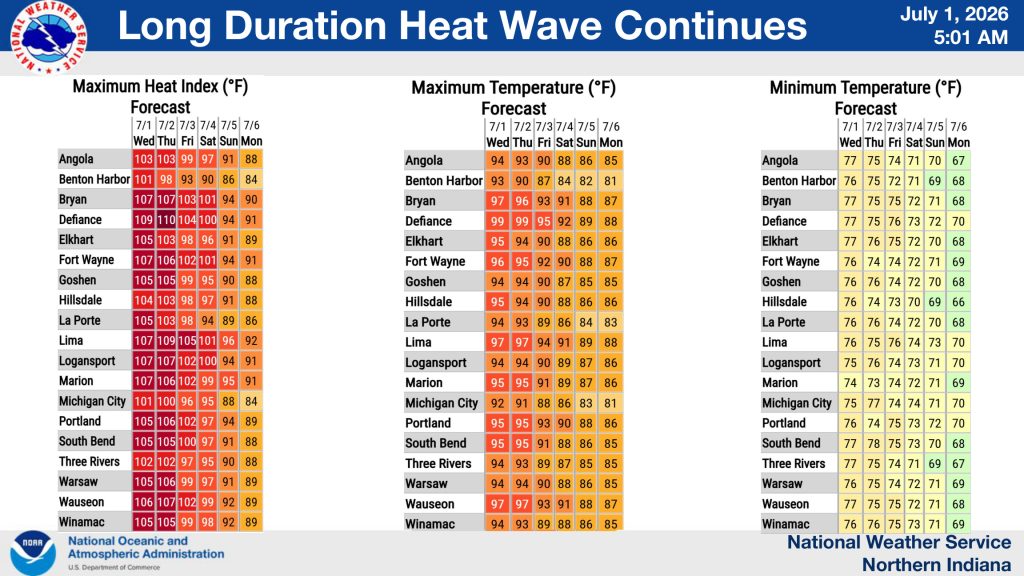
FORT WAYNE, Ind. (WOWO): Dangerous heat and humidity continue across Northeast Indiana and Northwest Ohio Wednesday, with heat index values expected to climb between 102 and 110 degrees for the second straight day.
The National Weather Service says afternoon high temperatures will range from 92 to 98 degrees, but the humidity will make it feel significantly hotter. The dangerous heat is expected to continue through Thursday before temperatures begin to ease heading into the Independence Day weekend.
 Tuesday’s heat was already oppressive across the region, with several communities recording heat index values above 105 degrees.
Peak Heat Indices Tuesday
- Van Wert: 111°
- New Haven: 110°
- Spencerville: 110°
- Garrett: 110°
- North Fort Wayne: 109°
- Hamilton: 109°
- Auburn: 109°
- Angola: 106°
- Huntington: 103°
- Columbia City: 103°
- Fort Wayne International Airport: 102°
- Kendallville: 102°
- Decatur: 100°
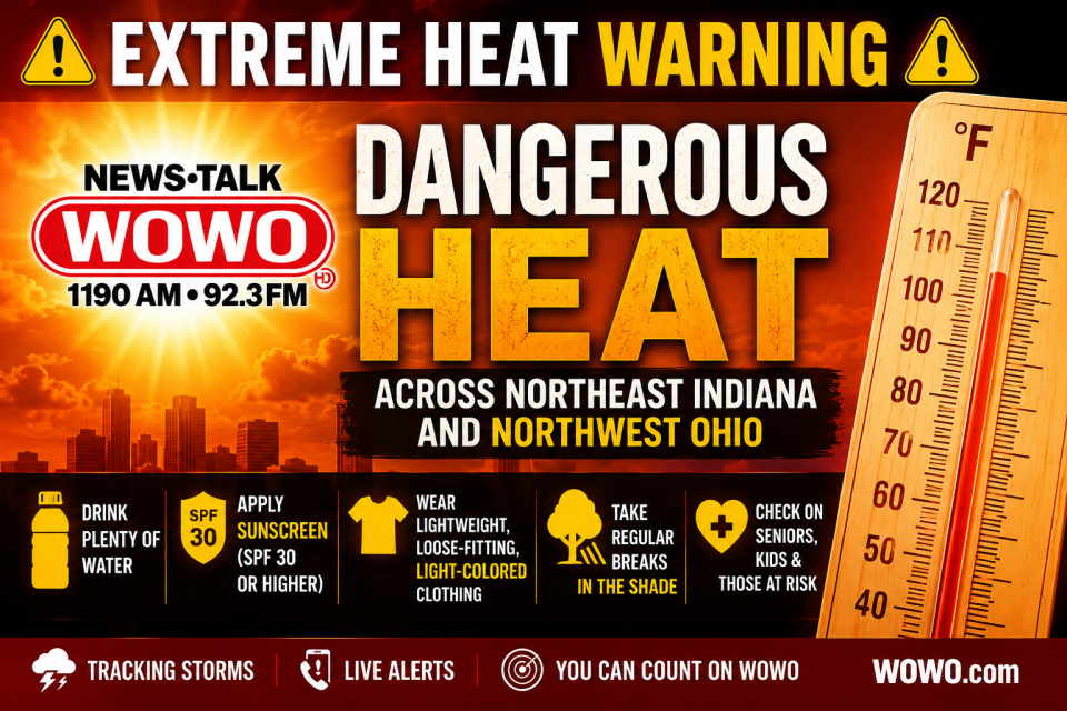
 The National Weather Service warns that prolonged exposure to these temperatures can quickly lead to heat-related illnesses, especially for older adults, young children, and anyone working or spending extended time outdoors. Residents are urged to drink plenty of water, wear lightweight, light-colored clothing, take frequent breaks in the shade or air conditioning, and never leave children or pets inside parked vehicles.
Relief Coming This Weekend
The extended heat wave is expected to begin breaking by the weekend. Forecast highs will gradually fall into the mid to upper 80s by Sunday, bringing more seasonable conditions to Northeast Indiana and Northwest Ohio.
Strong Storms Possible Friday
As the heat begins to break, the chance for thunderstorms will increase.
The National Weather Service has added a marginal risk for severe weather on Friday, with scattered showers and thunderstorms expected to develop during the afternoon and continue into the overnight hours. While widespread severe weather is not expected, forecasters say a few storms could become strong enough to produce:
- Damaging wind gusts up to 60 mph
- Isolated large hail
- Frequent lightning
- Torrential downpours with rainfall rates of 1 to 2 inches per hour
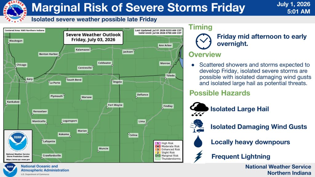
Forecasters encourage anyone with outdoor plans for the holiday weekend to stay weather-aware and have multiple ways to receive watches and warnings. Confidence in the timing and coverage of Friday’s storms remains low, but isolated severe weather is possible.