

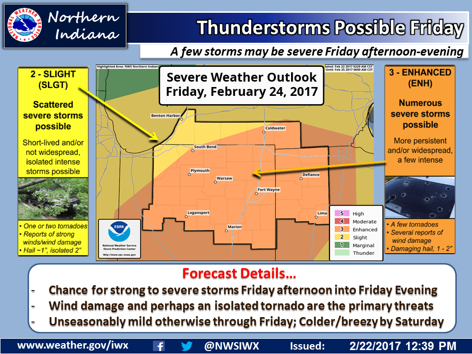
FORT WAYNE, Ind. (WOWO): We could be in for a bumpy ride Friday.
The National Weather Service says there’s an “enhanced” risk of severe thunderstorms in northeast Indiana Friday afternoon and evening, and that includes Fort Wayne, Allen County, and the rest of the WOWO listening area, which includes DeKalb, Steuben, LaGrange, Noble, Kosciusko, Elkhart, Wabash, Huntington, Whitley, Wells, Adams, Grant, Blackford and Jay Counties.
National Weather Service Meteorologist Megan Dodson tells WOWO News it’s just a possibility, for now:
“But we do want to mention it, because it’s kind of an unusual thing for this time of the year,” Dodson says. “Unfortunately it can be difficult to tell any real details, even within 24 hours of the event, but our main threat looks to be damaging wind gusts.”
The Weather Service’s statement says we could see “numerous” severe storms, including the possibility of some tornadoes.
Text “NEWS” to 46862 to stay up-to-date on severe weather alerts.
