
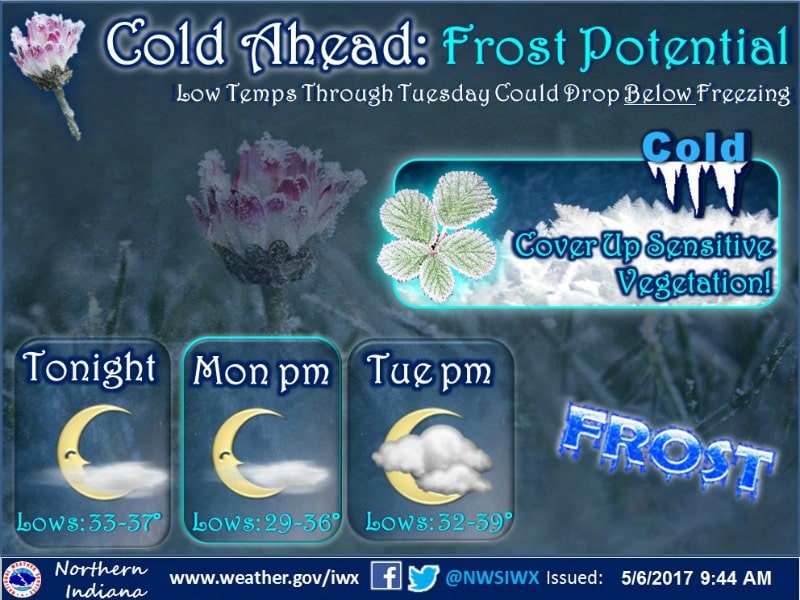
UPDATE: The National Weather Service has issued a Freeze Warning, from 2 a.m., Monday to 8 a.m., Monday. Temperatures are expected to reach near freezing Monday morning with areas of frost likely.
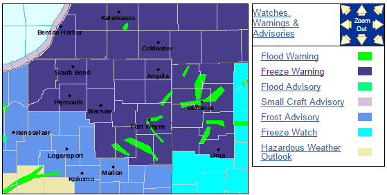
IMPACTS...

* IMPACTS...Sensitive vegetation may be damaged or killed if
  proper precautions are not taken.

PRECAUTIONARY/PREPAREDNESS ACTIONS...

A Freeze Warning means sub-freezing temperatures are imminent or
highly likely. These conditions will kill crops and other
sensitive vegetation.

A Frost Advisory means that widespread frost is expected.
Sensitive outdoor plants may be killed if left uncovered.
ALLEN COUNTY, Ind. (WOWO): Some cooler temperatures pushing through northern Indiana could lead to widespread frost.
According to the National Weather Service, slight flooding along rivers in the Maumee and Wabash River Basins will be ongoing Saturday, though flood waters will start to recede this weekend. An afternoon shower east of I-69 is possible, with highs reaching into the lower to middle 50’s. However, come the evening, temperatures will fall into the 30’s with some patchy frost by daybreak Sunday.
A more widespread frost is likely late Sunday night into early Monday morning. It’s recommended that you cover up sensitive vegetation.