

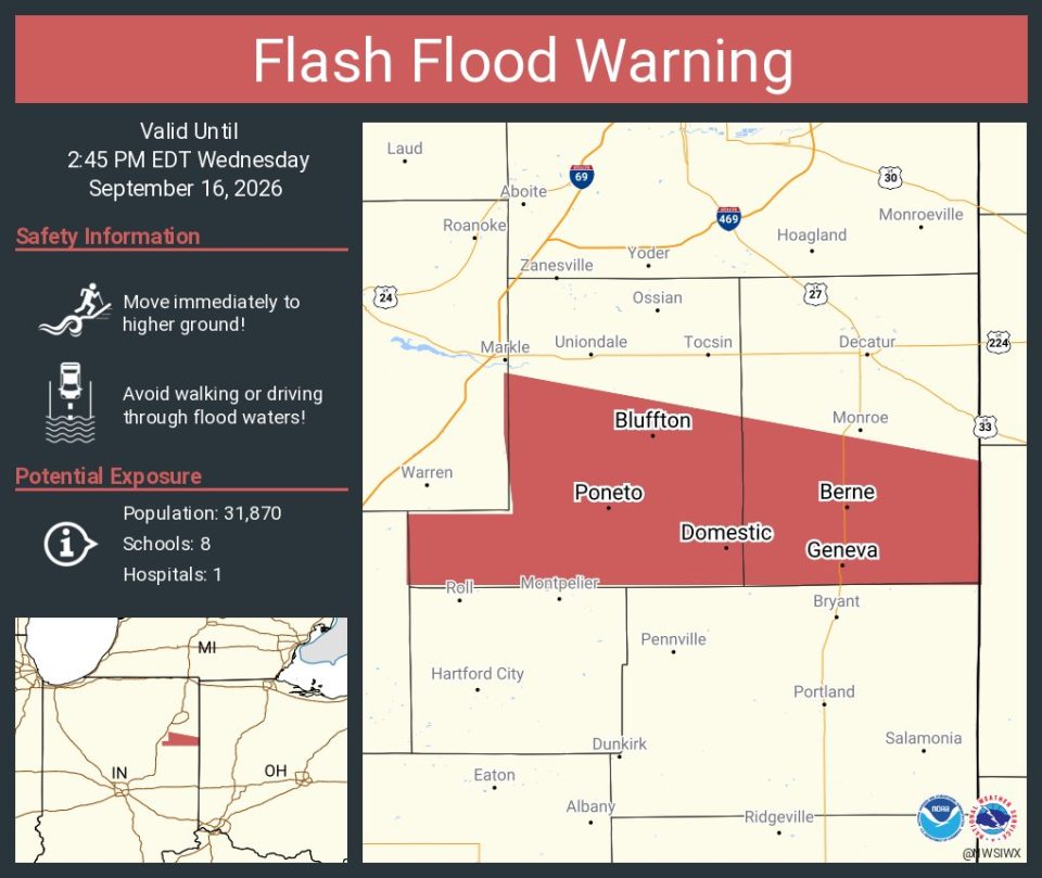
FORT WAYNE, Ind. (WOWO) — Additional rainfall could lead to localized flooding Wednesday morning in parts of northeast Indiana and northwest Ohio, particularly in areas that received heavy rain over the past 24 hours.
The National Weather Service in Northern Indiana says showers and a few embedded thunderstorms are moving across the region Wednesday morning.
Localized rainfall rates of 0.5 to 1 inch per hour could produce minor flooding. More significant flooding, including the potential for flash flooding, is possible in areas that received the heaviest rainfall Tuesday evening. The National Weather Service issued a flash flood warning for cities including Bluffton, Geneva, and Berne.
The National Weather Service highlighted an area stretching across portions of northern and central Indiana where additional rainfall could create a greater flooding threat.
Rain is expected to taper toward midday, although additional scattered showers and thunderstorms are possible Wednesday afternoon and into the early evening.
Residents in areas that received heavy rain should be alert for water-covered roads and other signs of flooding, particularly if additional heavy rain develops.
The heaviest rainfall amounts occurred last night in southern Wells and Adams counties. For more information, click here.

